Photogrammetry And Surveying Explained
Have you ever wondered how photogrammetry and surveying go together? Did you even know they did? While you might not even know the meaning of these two terms or how they are related, photogrammetry and surveying is a technique that many people benefit from without realizing it.
Photogrammetry and surveying are processes formed to assist people with roadwork and creating marks for locations on a map. This process can be used for many things, like evaluations on whether a road would fit in a specific area or not.
You might have more questions about photogrammetry and surveying, and that is okay. Keep reading this article for a more detailed explanation about how the two work together and all of the pros and cons that come with them.
What Are Photogrammetry And Surveying?
You may have heard of photogrammetry in passing without understanding what it is all about and how it is related to surveying. If that is the case, hopefully, those definitions will soon be cleared up. Photogrammetry is a kind of surveying technique used in a variety of ways. Some examples of photogrammetry surveying being used are:
- Creating 3D-Documentation for buildings.
- Determining if roads will be able to be built in a specific area.
- Adding relevant and very detailed landscape locations and images to maps.
- By getting measurements for certain landmarks and locations on a map.
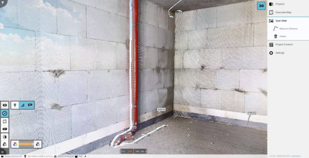
Many people are visual learners and do best when they are looking at a design, example, or measurement that is right in front of them. The idea behind photogrammetry is that those who are surveying with the photogrammetry process will be able to collect and measure vital knowledge on locations and the areas around them.
While this might seem like a new technique, it has actually been around for some time. Leonardo Da Vinci was the first person to hint at this, and he stated that it was a necessary thing to do.
The technology was first used around 170 years ago by Aimé Laussedat, being thought of as the “father of photogrammetry.” It has since moved from a process that was mainly done by the human eye to a process that is now done strictly on computers and with the help of other technology.
The Different Types Of Photogrammetry
When talking about different types of photogrammetry, there are usually two categories that most people are talking about: terrestrial photogrammetry and aerial photogrammetry. Each category gives viewers different perspectives and can capture different environments and landscapes as well.
For terrestrial photogrammetry, you are focusing on a perspective that is on the earth. It is much more up close than aerial photogrammetry, and it is more simple to set up than aerial due to it usually being handheld or positioned on a stand. When thinking of terrestrial, think about things similar to buildings, bridges, and roads.
With aerial photogrammetry, the camera is off of the solid earth and takes pictures from above. They are almost always captured by drones, which is an inexpensive way to receive pictures of good quality compared to having to rent an airline.
There is also a different type of photogrammetry, which is known as satellite photogrammetry. This type of photogrammetry is not used very often and does not always make it to the public eye. However, it is what is mainly used by GPS systems.
How Is Photogrammetry Used In Surveying?
Even though the description above may make using photogrammetry in surveying seem like it is focused solely on things such as mountains and cornfields, there can be other ways that photogrammetry is used in surveying. For example, photogrammetry might be used in surveying with:
- Architects and engineers, when they would like to get precise measurements for construction sites and buildings so that everything will be sure to go as it is planned.
- Forensic investigators when they are trying to get an accurate depiction of how an accident happened so that they have a better idea of who is in the wrong.
- Getting correct sizings for animals in different parts of wildlife.
All of those cases, when using photogrammetry, can give excellent visual examples to those seeing them. There are also some other areas that succeed when using photogrammetry surveying. You will want to keep reading and see how much this surveying technique has to offer.
Archaeology
If photogrammetry was primarily used for landmarks, roadways, and the environment as a whole, it is safe to say that any archaeologist would want to use this. Using photogrammetry, they can form 3D models from images taken, or in some cases even from images found on the internet.
This 3D model formation is an excellent way to understand what previous life was like before we could live it for ourselves. Imagine how many great models we could have of bones that were first captured on a camera decades ago, if enough images were taken. This would be wonderful to use for designs that are not only used in research but also placed in museums.
Additionally, it provides a way to see the details of something without any risk to the object. Even if photogrammetry is not the only option, it might be the safest when fragile things come into play.
Sports
The Pros And Cons Of Photogrammetry And Surveying
Like with almost everything on earth, there are both pros and cons when you begin to think about photogrammetry and how it is a form of surveying.
The fact is, not everyone knows very much about photogrammetry, and it is important for someone to understand both the good things and the bad things before forming their own opinion.
Pros Of Photogrammetry
There are many people who applaud the concept of photogrammetry, as it is something that many businesses, companies, and individuals use successfully. When you are using photogrammetry, you will get an accurate depiction and measurements of whatever object or structure you you took of.
Other benefits also include:
- It is very convenient for those who have to use or refer to any measurements. If something was not measured correctly or skipped over, the 3D model can be measured again anytime. This means a decrease in potential travel expenses and an increase in productivity.
- One great thing about photogrammetry and surveying is that, especially with prehistoric places, buildings, and historical finds, is that it gives a very natural and normal look. Sometimes some designs that do not use this technology can look unnatural and fake, but photogrammetry gives you the best possible look.
- Photogrammetry allows those who have taken the pictures and measurements to easily explain places and situations to other people who may not have as much context. Instead of having to use technical terms that many will not understand, the 3D model will give people a visual to look at and learn from.
- There is also the fact that the cost is much lower than other technologies people consider when thinking about photogrammetry.
Anyone who has even played a sport or on a sports team knows that precision can sometimes be the deciding factor in if a team wins or loses. And because this is the case, photogrammetry is the perfect solution if a team has a problem with accuracy.
With photogrammetry, viewers are allowed an up-close and digitized look at how a body needs to be exactly positioned to do something successfully. This technology is especially useful to sporting teams such as:
- Basketball: When used in basketball it can help for shooting free throws and how to correct your shooting form.
- Soccer: When a soccer team is trying to figure out how their hips need to rotate to kick the ball at the right angle, photogrammetry can be incredibly useful.
- Tennis: It can be used so a player will know what angles to hold their racquet at and when the correct timing to hit the tennis ball is.
The use of photogrammetry and surveying is not limited to those sports, however. Other sports it can be useful for include ice skating, hiking, and baseball. These all require the intricate details that the process of photogrammetry and surveying can provide.

Cons
Even though the practice of photogrammetry and surveying has quite a fan base, it is not a perfect. There may be a variety of reasons why someone would no go for this technology, some of which may include:
- Some areas are truly not ideal for photogrammetry to be used. Even though taking pictures is much more convenient than having to travel multiple times to a single place, there are certain locations where pictures do not turn out well. For instance, dark places.
- The weather can also be a major factor when it comes to photogrammetry and taking pictures. Nothing will look good or turn out the way it needs to be if there are raindrops on the camera screen.
- Light needs to be present, but without too many contrasts. Even if you are working with the sun shining, if the lighting is not the way it needs to be, your picture might have too many bright or dark areas. This will can create problems to generate an optimal 3D model.
- Sometimes when you are capturing roads or buildings, there are certain items in the way that do not allow you to get the perfect snapshot. It could be a tree, overgrown plant life, or even a large billboard that unexpectedly came up. People become quickly frustrated with how many obstacles they encounter on the job.
- The price of the software can oftentimes be high. If you are looking for very high precision, you will need a very good camera, which is usually quite expensive.
Keeping these pros and the cons in mind is important in order to take a good decision on whether you need to use photogrammetry.
What Programs Are Good For Photogrammetry?
If you have decided that you would like to look into photogrammetry and surveying some more, you will want to know what types of programs and software will work best. It is important to know if you are investing in a good or bad program before you buy it.
Finding the software that you want is one of the most important parts of the photogrammetry process. You need to make sure that the software will be able to do the following things:
- Allow the user to edit and make changes to the original picture and 3D model.
- Let you save in many different ways to a variety of different platforms.
- Actually be able to change the images from the original snapshot to a 3D design.
Some of them may cost more than you would like to pay, while others do not charge you anything other than your time while on them.
Other Important Things To Know About Photogrammetry Used In Surveying
Besides understanding the pros and cons of photogrammetry, there is other important information that you will want to know about before you begin. It can sometimes get overwhelming and confusing trying to find out all you need to know, but these next few points should give you a better understanding of what will be happening.
- You need to take pictures from all possible sides and angles. Your resulting model will not do what it needs to do on the measuring end of things if you are did not get enough pictures from all areas.
- Take many pictures. There will not be anything else more frustrating than realizing you do not have enough angles or perspectives for your measurement and design. It is no problem if you take many pictures, but there will be if you do not have the right amount.
- Know that your computer needs to be up to date before you are able to download the photogrammetry software that you need.
- If working with aerial photogrammetry be sure to find a drone that will suit you and your aerial views the best. Remember that the more expensive drones are usually of better value, but that is not always the case.
- It is important to look at your resolution and make sure that you are taking pictures at the highest setting. Details are extremely important in these kinds of pictures, and a high resolution allows for intricate details to be seen.
Additionally, whether it is on a drone or in your hands, your camera needs to be of the best quality possible. This is an expense that many people are not ready to take on, but it can make the difference between decent and excellent pictures that do or do not capture important details.
Conclusion
All in all, photogrammetry is becoming used in a variety of ways in today’s society. It is a type of surveying that use a 3D model created from pictures to accurately represent and measure where things are and what things look like.
There are, of course, advantages and disadvantages to using photogrammetry in comparison to other technologies. Still, it is up to you to decide what suits you and what you are working with the best. Before you begin, be sure you are well informed of what to expect to happen and remember that it is a learning process that will take time.
Contact us
Whether you just have a small question or want to get a customized offer from us:
Contact us now.
We are happy to help you.